 Trips : Utah : Canyonlands National Park : "Island In the Sky" is the northern portion of Canyonlands National Park. This page contains a bit of history and geological information, as well as a series of photo tours listed below. As mentioned on our main Canyonlands page, this area is appropriately named. It truly feels like an island in the sky. There is a very slender connection to the "mainland" called the Neck, and a drop of over 1,000 feet to the canyon below on all other sides. There is, however, a natural spring near the Neck. For this reason, this area was used as a natural holding area for livestock. Settlers — early ranchers — would drive livestock on to the island and fence off the neck. The natural contour of the land formed a boundary everywhere else, and the fence only needed to be about 40-50 feet long. A big labor saver! To see how the Neck area really looks would be difficult without a picture from the air. But here is a section from one of my topographical maps of the area to give you some idea of how it looks...  Topographical map showing the Neck connecting Island in the Sky to the mainland Canyonlands National Park The top of the mesa had quite a few advantages, and the earliest Native American settlers used it to their advantage. There are flat areas to plant and harvest grain, natural springs, and areas for shelter. The trail to Aztec Butte takes you past some ancient granaries and other structures. There is also a large hole that is either a collapsed salt dome or a meteor crater; they are still debating the final answer. And one of the most dramatic sunrise photographs from the area can be taken at Mesa Arch, which is the subject of one of the pictorial tours below. Finally, outside the entrance to this national park is Dead Horse Point, a Utah state park. You will have to pay a second entrance fee if you go, but it is worth it. It is an excellent spot for early morning photographs. Current Photo Tours for Island in the Sky
|

Trips
Themes
Gallery
Techniques
Blog
Site Map
Search
Further Reading
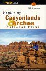
"Exploring Canyonlands and Arches National Parks"